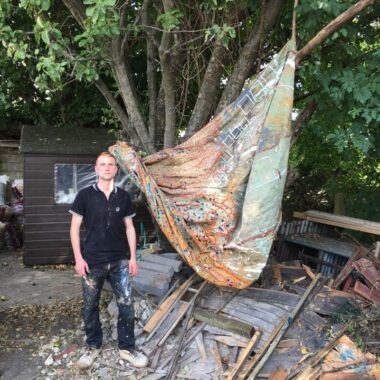
Edited by Sandra Crisp LG
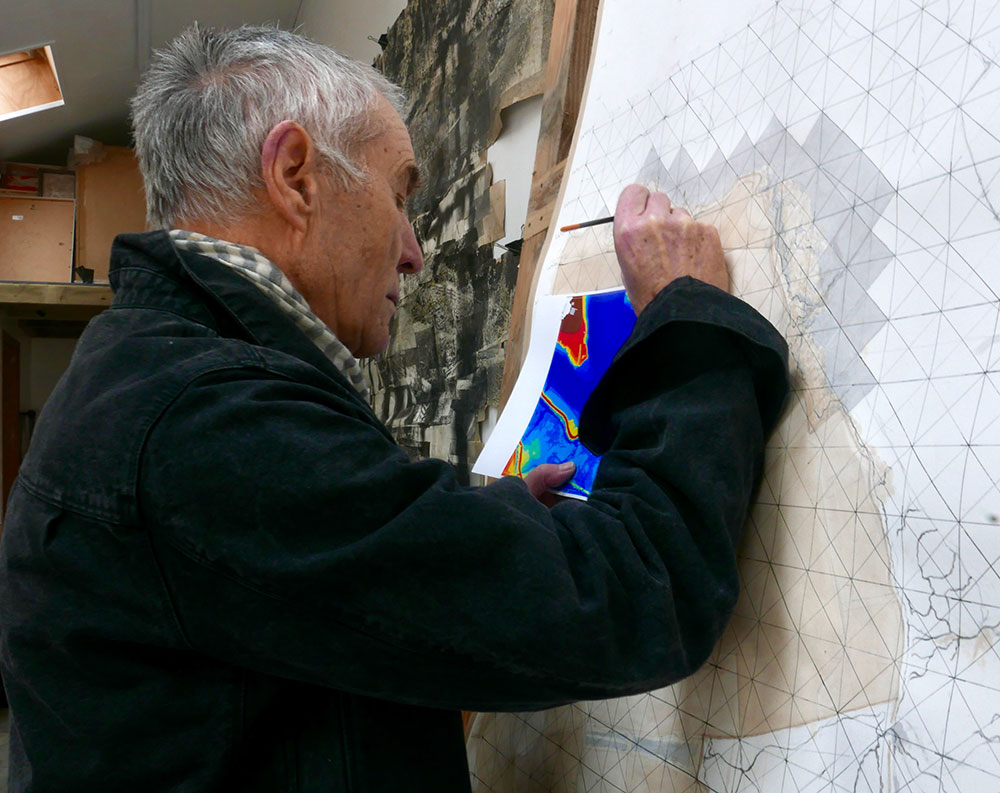
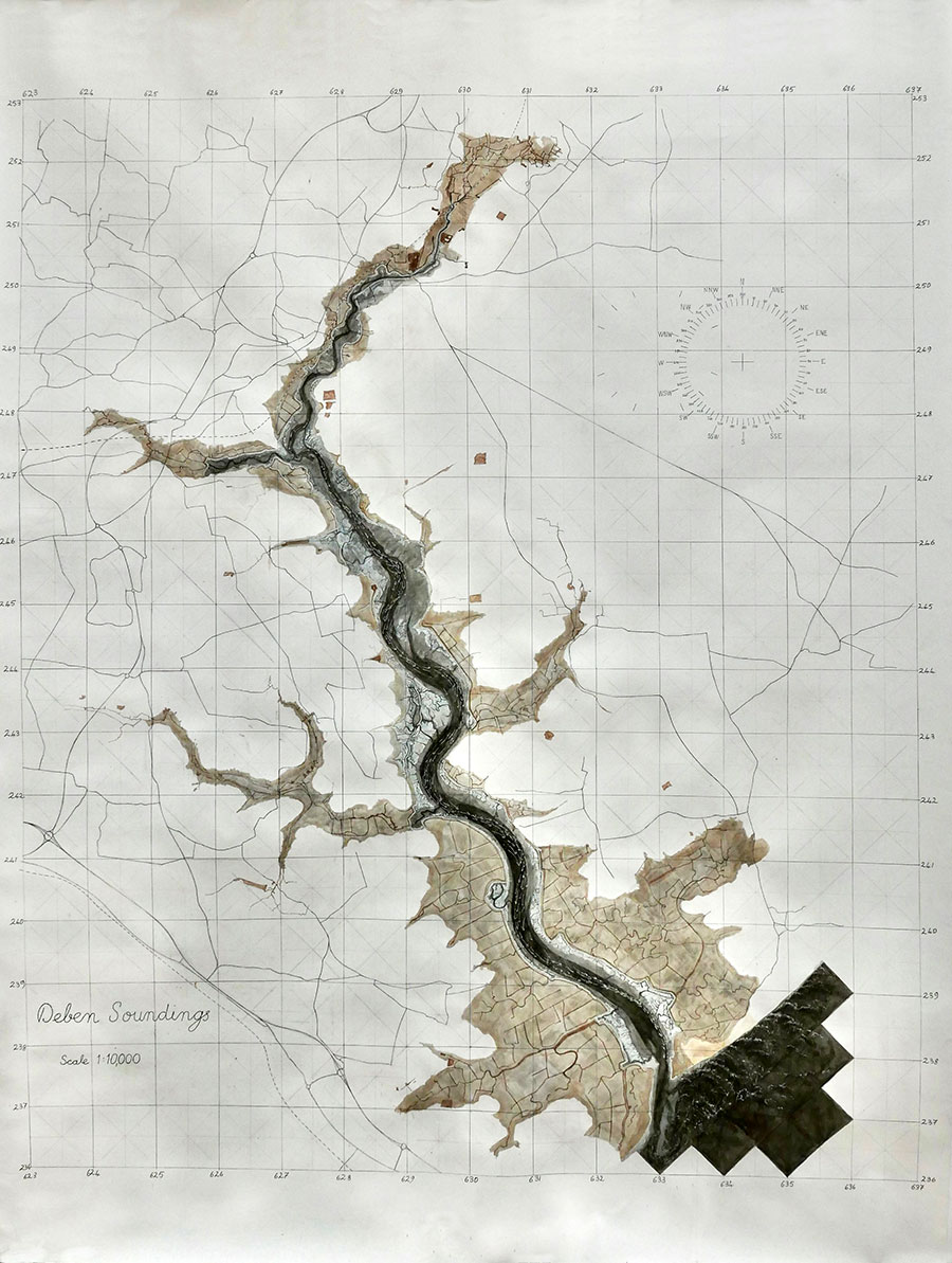
Sandra Crisp LG: Working with communities to encourage understanding of coastal and estuarine change is integral to many of your projects, including Deben Soundings 2022. Map works, for example, are directly informed by information from various charts, OS maps, Environment Agency Indicative Flood Plain Maps and aerial surveys: ‘The aim in my drawings is to visualise the analyses made by coastal scientists’. Also, you mention that the integrity of the drawing process and the behaviour of medium is an active part of the contemplative process and lends the discussion another level of immediacy that would not be possible if treated just as information.
Previous work also includes Seamarks-Panoramic Camera which uses a hand-built camera attached to a small boat, operated out at sea.
Hearing more about the use of different materials and processes or any other elements you are happy to reveal, will be really interesting.
In 1980, I moved away from an increasingly unaffordable warehouse studio way of life in London, bought a decommissioned cargo barge in Holland and brought it to the Deben Estuary in Suffolk, living and working on board for the next forty years. It can be appreciated this move meant a completely new way of life and a gradual shift in my practice from the appearance of landscapes to becoming immersed in how they work. When I first arrived in Suffolk I expected to continue working with an expanded form of photography but landscape processes became increasingly persuasive and the rhythms and volatility of a tidal estuary began to seep into my practice. In 1993 I was offered an artist residency on the Upper Thames for the Countryside Commission (now Natural England). This was immediately prior to the completion of the Thames Path as a new national trail where my role was to spend a year on the river, walk all 210 miles of it, get to know the working community, develop a personal perception of the river, produce a body of work, write a report, and suggest potential ideas for commissioned works. But, on no account was I to treat it as an excuse to make signature artworks. What came out of that year was an intensive study of flood control in the Thames Valley, focusing upon the need to mitigate as much as is humanly possible the risk of disastrous flooding of the Thames Flood Plain through the use of highly engineered weir structures and sluice works the length of the river. For this work, I researched the range of hydraulic solutions used to corral the river in times of spate and produced three 10ft/5ft drawings of different weir designs and the wave structures and downstream turbulence caused by their discharge. This one product from the residency gave me an appetite for the future use of my skills to visualise, imagine and immerse myself in how natural systems work and through this, make them accessible for communities.
My incentive to work more directly with communities came after other commissioned projects which included “A Profile of the River Thames from Thames Head to Sea Reach at Thames Barrier” in 1996 and “Memory and the Tideline for the flood defences on Poole Town Quay” in 2001 for which it helped to be conversant with fluvial and coastal systems and their management. In 1997 the Environment Agency started the consultation process for a new estuary strategy for the River Deben, and there was a call for someone to represent the community in the discussion. Since I already had a modicum of experience in the area, I considered this an opportunity to involve myself with a grounded project.
Now several years later with more project work accomplished I have become a member of the executive charged with setting up an integrated management plan for the Deben estuary and its immediate coast.
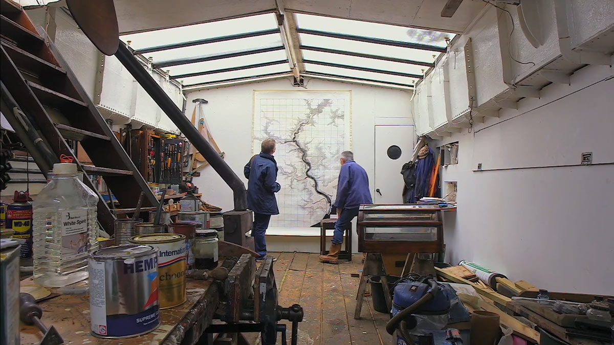
The map of the river Deben was first laid out in 1997 when I agreed to act as community representative for the development of a Deben Estuary Strategy by the Environment Agency and its first purpose was for me to familiarise myself with the estuary and its systems to be able to engage with a degree of knowledge. As an artist, my first instinct is that by immersing myself in a drawing, I can reach beyond representation to become the idea. Making my own drawing is an act of rediscovery of landscape and renegotiation of it including essential datasets and the questions to be addressed. To my mind, making a drawing is not so much policy rendered as information but more a parallel reality and re-enactment of place.
Very much in sympathy with Paul Klee and Johannes Itten, I consider drawing to be a primary experience, which is why I have sought ways to emphasise the importance of method as an active conduit for ideas and not a passive vehicle for information. With the map works, one of my first influences was that period when the science of surveying was in its infancy and maps took a hybrid form of measurable data dignified by heraldic devices and made digestible through pictorial conventions. For me this became a means to explore the difference between looking through a drawing as a window to access information or at it as an object with its own integrity, all very Clement Greenberg. This question becomes more pertinent with the need to reach out to communities when the sensual experience of the drawing is the hook by which it performs as a vessel for information and coincidentally, becomes a more deeply satisfying experience in its making.

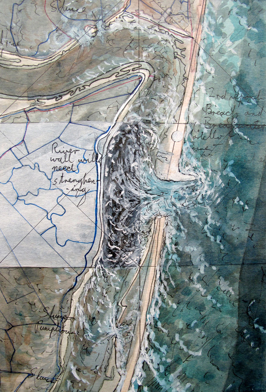
The map works are usually made for a specific purpose and therefore must be accurate and to scale, which demands a vertical and horizontal grid corresponding directly to the standard grid reference system, ensuring that information is transferable from source to map to application. Recently, I have added a diagonal grid to ensure greater accuracy in transferring information and as a guide for layering surface washes minimising confusion between cartographic detail and the physical application of paint. Most of these works are large-scale and can be anything from 1/1.5m to 1.5/3m and I tend to work with them mounted vertically, either on a board or directly on the wall. Consequently, the use of a grid helps control flow and contributes a structure that reinforces the picture plane and separates it from the information it must support.
This is topographical information translated into the language of drawing and offers itself as a primary sensual experience rather than a secondary interpretation of data. The close examination of diverse data within a drawing is a meditative and reflective act, where making something happen as drawing allows me to reflect on how it could be in the future.
Method itself has meaning and is not just a means to an end: a defence wall may be described by a line because that is what it is and militarily speaking it is a line to be held, but a flood plain is much more nebulous and cannot be determined by a line, it is a zone that will flood should a defence wall fail and denotes risk. Saltmarsh is a porous, fragmentary and transient entity that does not lend itself to strict delineation. Land drains are not lines drawn on reclaimed land but are a component of the land itself, just as relic saltmarsh channels pressed into use as drains appear as calligraphic squiggles.
When faced with tough infrastructural decision-making, these distinctions may seem woolly and fanciful, but they provide an opportunity to reflect upon the delicate balance between what can be determined and might be controlled and what is contingent and prone to change. Watercolour drawing offers a remarkable equivalence, it is a re-enactment that allows reflection and a point of entry into a conversation where I could otherwise find myself utterly out of my depth.

The Seamarks project arose from a long-standing rhetorical enquiry over what we mean by objectivity and framed my mistrust of our systemic approach to nature: finding myself living on the water in a coastal environment in 1980, my immediate challenge was to adapt the practice I had developed in a solid warehouse structure to an unstable and fickle marine environment and in this instance to make instability a dynamic part of my process. My response was to construct a hand-driven panoramic camera that would be as responsive to the ambient conditions of a moving platform at sea as it is faithful to the appearance of a seascape. This introduced another level of information and ambiguity into the relationship that was the product of the circumstances of its making. The first trial of the camera was in 1983 for a series of 20ft photographs of the Colne and Blackwater Estuaries to be installed in the corridors of the new Colchester District and General Hospital. Subsequently, I followed these up with a series of coloured photographs made on the approaches to our Deben Estuary from the open sea, in all weather conditions, from flat calm to severe storm. Although the experience of making was dynamic and much more akin to the immersive Turner experience, the intention of the series was to be a meditation upon the relationship between control and acquiescence in the making process and has sensitised me to the range of influences active but often unacknowledged in the physical and temporal act of making. Evidence of this ranged from a tiny sine wave punctuated by a rhythm of nodes running the length of one image that corresponded directly to the beat and stroke of the motor to the uneven horizon in the image, the result of the rolling of the boat during the scanning process.

The urge in this work to harness ambient conditions as active components in the making process led me to look beyond the appearance of the estuary to its behaviour as a dynamic system and to sublimate my practice to coastal and estuarine change as a cultural as much as logistical challenge. For this the best move forward for me was to become an advocate for a higher level of community engagement in the management of landscapes and through collaborative initiatives with coastal scientists and engineers promote a more integrated understanding of coastal policy.
Simon Read LG 2023
www.simonread.info
Current Projects:
+ Deben Soundings project work including a book launch for “Between Flotsam and Jetsam” set for 14th April 2023 in Woodbridge, Suffolk, UK
+ Completing a paper on arts and environmental activism, and consulting on saltmarsh restoration work for Suffolk Wildlife Trust (Martlesham Wilds) and Suffolk Yacht Harbour
Videos:
Art and landscapes/Tidal protection
An attempt with McCarthy to reach the tidal limit of the estuary


